Get Inspired
Our Favorites
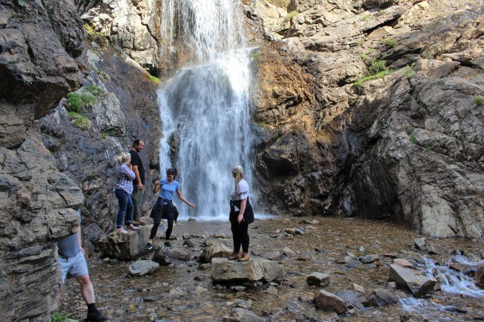
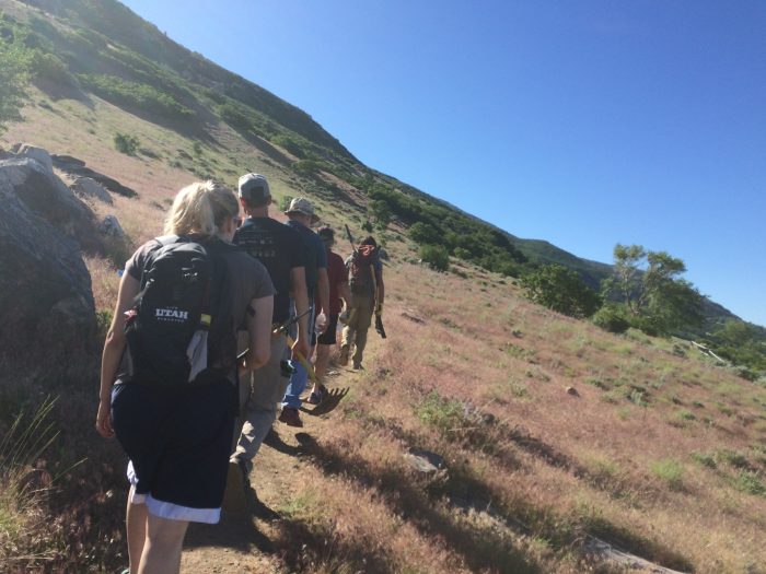
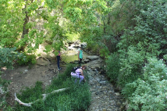
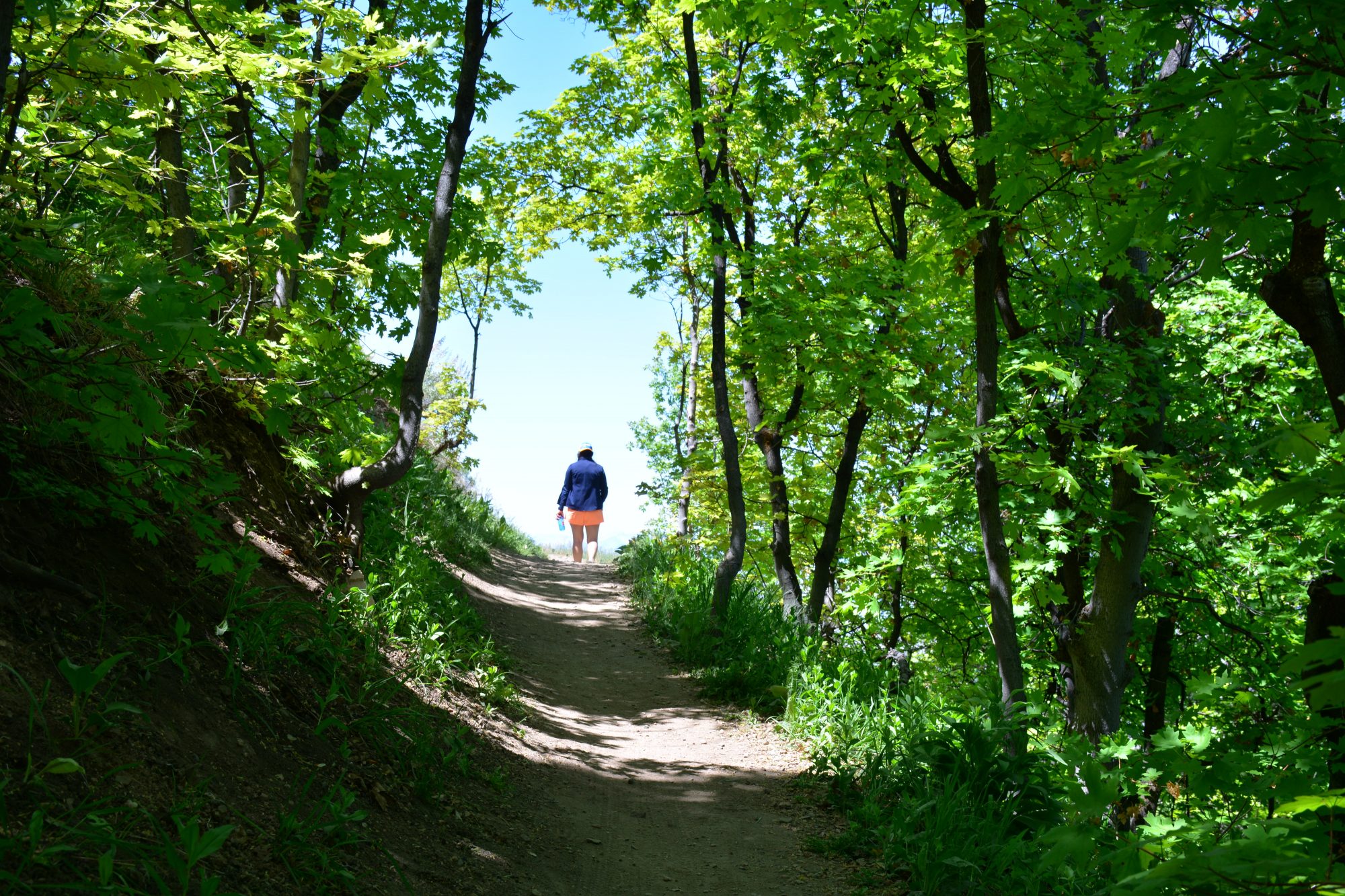
Adams Canyon
A classic Davis County trail, Adams Canyon is 3.8 miles out and back. With winding switchbacks that occasionally cross streams and great overlooks of the valley, it’s a beautiful trek. To top off the spectacular views along the way, take in the 40-foot Adams Waterfall at the end of the trail.
Trail Information
-
-
- Difficulty: Hard
- Distance: 3.6 mile
- Elevation Gain: 1420 feet
- Time: 2.5 – 3 hrs
- Trail Type: Out & Back
- Fees: No
- Dogs: Yes
- Parking: Yes / Small Parking Lot
- Restroom: Yes, at trailhead
-
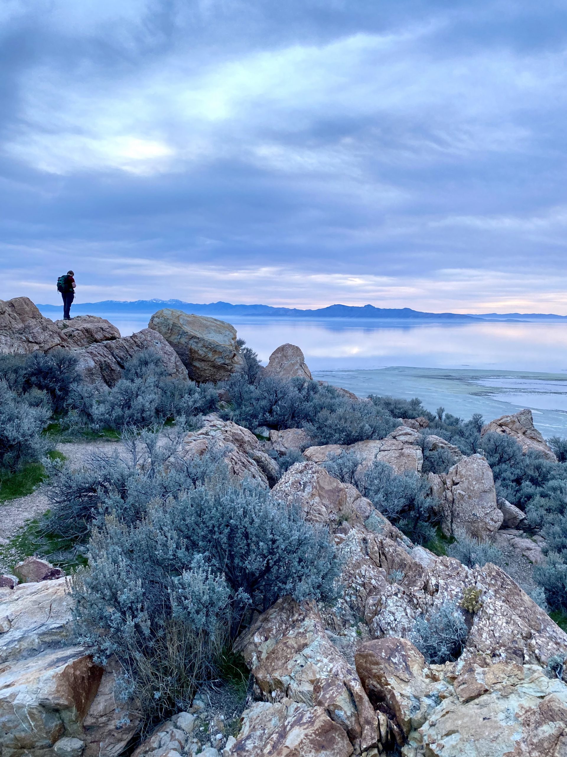
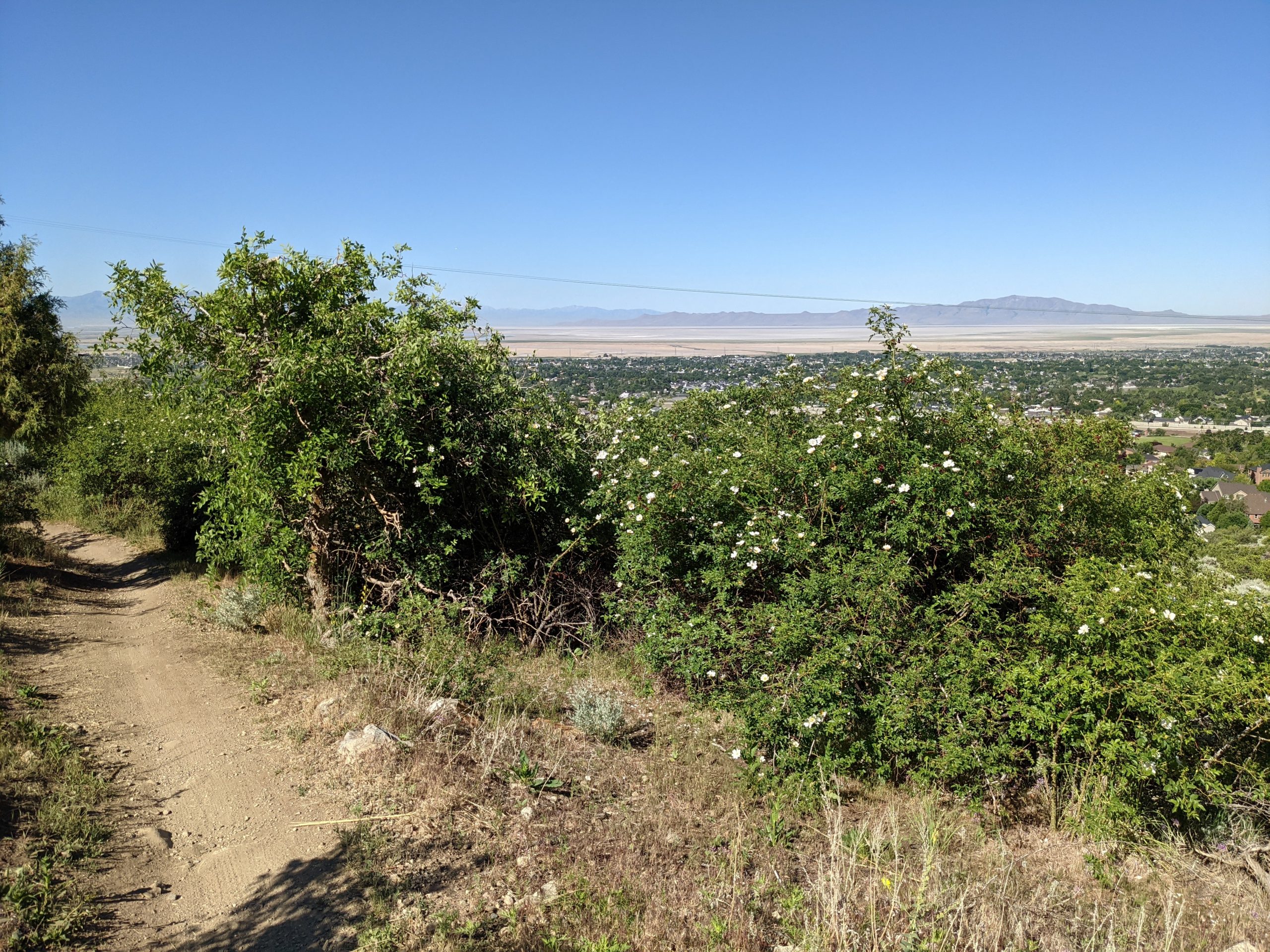
Buffalo Point
With 360-degree panoramic views, this less-than-a-mile hike in Antelope Island State Park is perfect for the family. While following the pathway, keep your eyes out for the island locals — bison, antelope, birds and more. Hike to Buffalo Point at dusk and reach the top in time for sunset. You won’t regret it!
Trail Information
-
-
- Difficulty: Moderate
- Distance: 1 mile
- Elevation Gain: 239 feet
- Time: 0.5 – 1 hr
- Trail Type: Out & Back
- Fees: State Park Entrance Fee
- Dogs: Yes
- Parking: Yes / Small Parking Lot
- Restroom: No
-
Flag Rock
Flag Rock is aptly named for the American flag that stands waving tall anchored to the rock formation at the top of the trail. To reach the flagpole, there are two trailheads to choose from — a north and south trail. The south trail is more commonly taken as it also connects to Patsy’s Mine Trail. Flag Rock was erected in honor of emergency personnel and others who perished during 9/11. The height from 100 north to the flag is the same height as the Twin Towers prior to their collapse.
Trail Information
-
-
- Difficulty: Moderate
- Distance: 4.5-miles
- Elevation Gain: 1,358 feet
- Time: 2.5 – 3 hrs
- Trail Type: Loop
- Fees: None
- Dogs: Yes
- Parking: Yes / Small Parking Lot
- Restroom: No
-

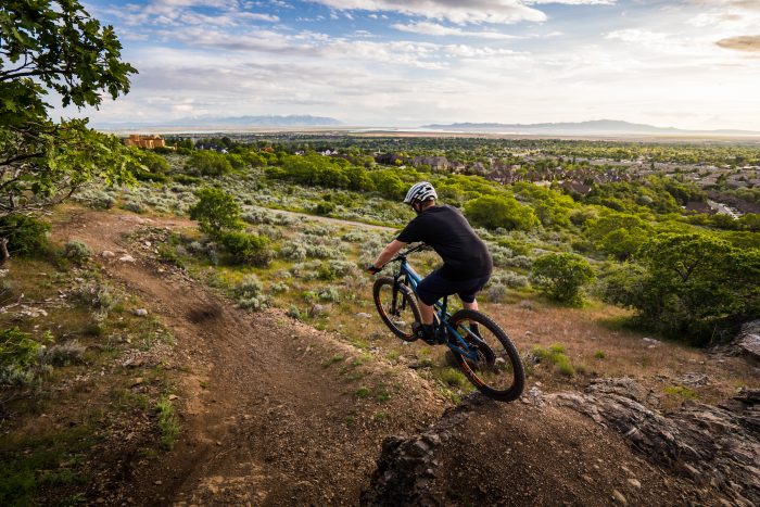
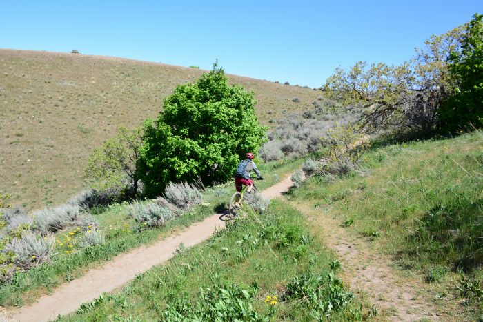
Fruit Loops Mountain Bike Park
Nestled in between Fruit Heights and the Bonneville Shoreline Trail, this mountain bike system has trails for all experience levels. The main outside loop is the easiest with off-shoot trails for more intermediate and advanced riders to enjoy.
Trail Information
-
-
- Difficulty: Easy- Intermediate
- Distance: 2.3-miles
- Elevation Gain: 255 feet
- Time: 30 min – 1 hr
- Trail Type: Mountain Bike Trail
- Fees: None
- Dogs: Not allowed
- Parking: Yes / Street Parking
- Restroom: No
-
More to Explore
Wild Rose
The Wild Rose Trails have both hiking and mountain biking trails for both types of adventurers. Within the system, paths will be marked if they are biker—or hiker-friendly. The trail system has enough smaller loops and paths giving you the ability to create shorter or longer loops along your way.
Indian Princess Grave
This family-friendly hike is 1.75 miles round trip. Starting at Farmington Pond, the trail will lead you past a nine-foot Big Foot statue and up to the burial site of a Native American princess — the daughter and grandchild of Little Soldier, a Goshute/Shoshone Chief.
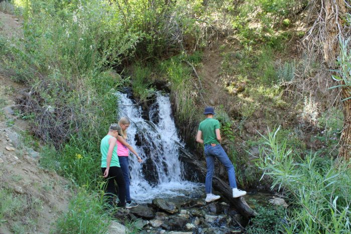
Parrish Creek
If you’re looking for a shorter hike with great views, this is the one for you. Roughly one-mile round trip, the Parrish Creek Trail will bring you to a waterfall and, if you go a little further, a panel of ancient pictographs. While this hike is short, it has steep inclines and isn’t recommended for young children.
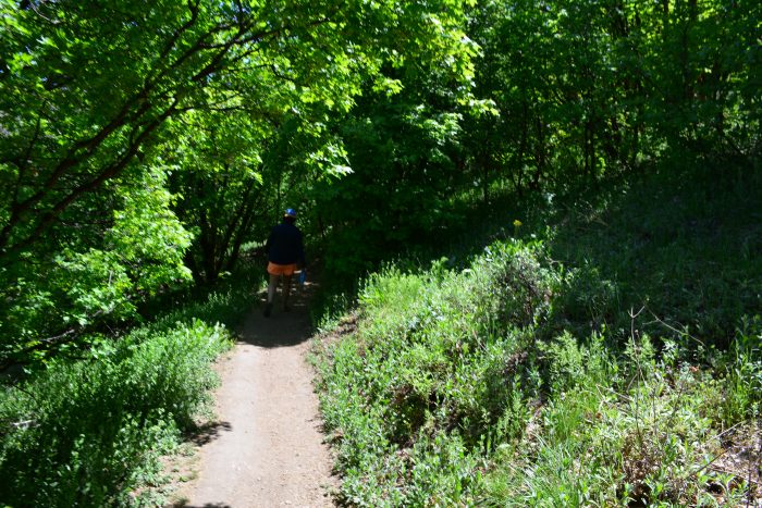
Holbrook Canyon
Located in Bountiful, the Holbrook Canyon Trail is surrounded by lush greenery and mountain streams. The full path will bring you to the ridgeline and it is roughly 5 miles one way. The canyon hike is great for trail running, hiking, snowshoeing, horseback riding and is dog-friendly.
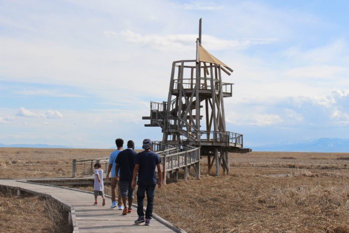
Great Salt Lake Shorelands Preserve
The best way to experience the Great Salt Lake Shorelands Preserve is along the one-mile boardwalk loop. Your family will love the views of the marshlands, the educational exhibits along the path and plenty of migratory birds that make Great Salt Lake a birdwatcher’s paradise.
Deuel Creek
Around 4 miles round trip, Deuel Creek Trail follows along the nearby creek. Cross over multiple bridges, swing on a rope swing and make it to the trail’s waterfall. Dog and family-friendly, Deuel Creek Trail is a fantastic way to spend the day with those you love.
Bonneville Shoreline Trail
Following along the Bonneville bench formed by the ancient lake, the Bonneville Shoreline Trail will eventually reach from Idaho down to Nephi. While the trail is still a work in progress, currently many of the completed trailheads are located in Davis. Mountain bike, hike or simply enjoy the views of the valley from the Bonneville bench.

The Grotto
Hike to this hidden gem along the east side of Hornet Canyon. The well-shaded trail will lead to a small grotto with a cascading waterfall. Hikers can cool off in the small pool at the base of the waterfall or stand under the 30-foot “water weep” overhang near the waterfall at the end of the trail.
Thurston Peak
Climb to the highest point in Davis County — Thurston Peak! This trail is 8.5-miles and best for experienced hikers to enjoy. At the top, enjoy views overlooking Antelope Island State Park, Great Salt Lake, all of Davis and even some of Salt Lake City. On the other side, you will be able to see into Morgan County and the backside of the Wasatch Mountains.
North Canyon
If you’re looking for wildflowers, mountain meadows and views of the valley, then North Canyon Trail leading to Rudy’s Flat is your perfect match. This is a great trail for hikers, mountain bikers and runners. This moderate-level hike runs about 7.5 miles round trip.
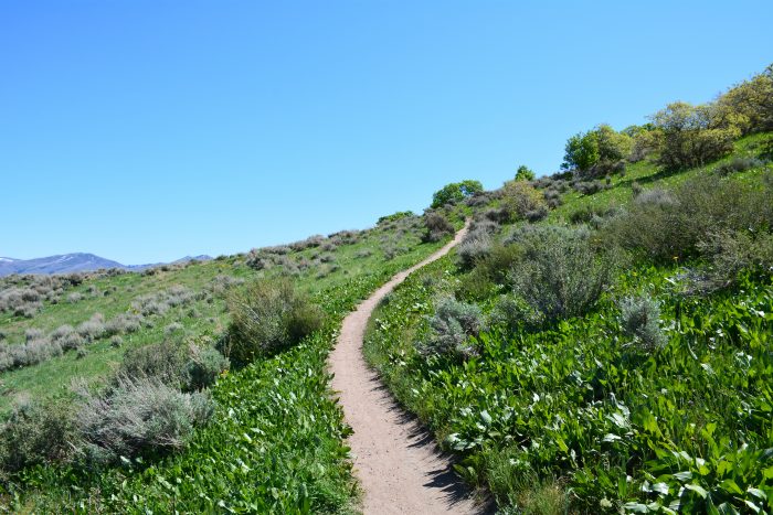
Travel the Trails
With the perfect mix of urban and rural, enjoy the cities and amusement centers. Then, get outside and refresh on a mountain trail.
Choose Your Trail